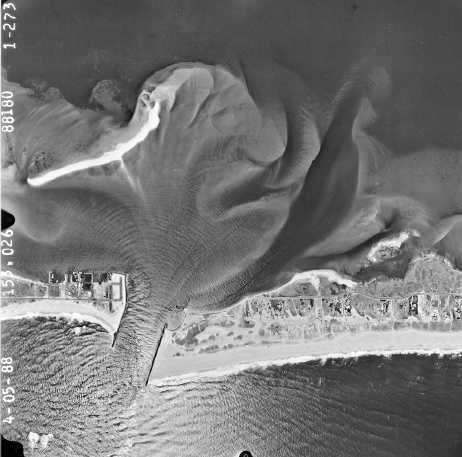
 April 5, 1988. Waves can be seen
entering the inlet and diffracting in a circular pattern in Shinnecock Bay. An
exposed sand bar in the flood shoal, previously straight or V-shaped, now
resembles a "T" with the growth of a spit southeast toward the inlet.
West of the west jetty, unvegetated beach sand extends up to the road. In the
1962 photograph, this area still had a vegetated dune. (Photograph by
AeroGraphic Corp.)
