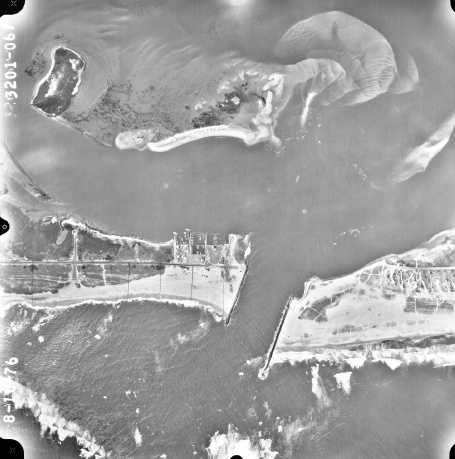
 August 10, 1976. This
photograph was taken one day after Hurricane Belle crossed the area. The west
beach is flush with the end of the west jetty because of beach fill. Compared
to 1962, the lobes and bars of the flood shoal have grown and moved further
north into Shinnecock Bay. The ebb shoal has also grown. Four black lines
crossing the west beach appear to be drawn with a fine pen on the photographic
paper print. (Photograph by AeroGraphic Corp.)
