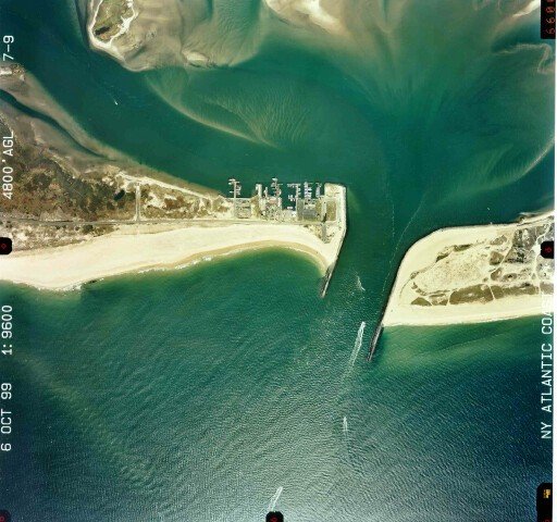
 October 10,
1999.Geomorphically, the inlet, beaches, and flood shoal have not changed
greatly in two and a half years since the previous photograph was taken. In
1998, 440,000 cu. yd. of material were dredged from the entrance channel and
the deposition basin and placed on the beach west of the inlet, in a zone
between the jetty and 3,500 ft west. The sand was placed as a berm between the
dune line and the water. This feature cannot be seen in this photograph because
of scale and file size constraints.
October 10,
1999.Geomorphically, the inlet, beaches, and flood shoal have not changed
greatly in two and a half years since the previous photograph was taken. In
1998, 440,000 cu. yd. of material were dredged from the entrance channel and
the deposition basin and placed on the beach west of the inlet, in a zone
between the jetty and 3,500 ft west. The sand was placed as a berm between the
dune line and the water. This feature cannot be seen in this photograph because
of scale and file size constraints.
