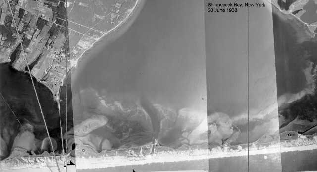
June 30, 1938. This photograph was taken before the Great New England Hurricane of 21 September 1938 cut Shinnecock Inlet. During the storm, the barrier breached where a channel crossed from the bay to the road. Another identifier of the future inlet's location is the left-right jog in the road, which disappeared when the storm washed away this part of the barrier. The channel may be a remnant of an inlet that was dug by the Shinnecock and Peconic Canal Company in 1896. This image is part of a mosaic prepared by the Beach Erosion Board, the predecessor organization of the U.S. Army Corps of Engineers' Coastal Engineering Research Center.
| << Index | Next >> |
| LIShore photographs and maps |  |
LIShore home page |