Freeport station location.
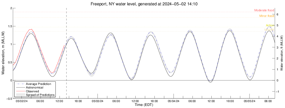
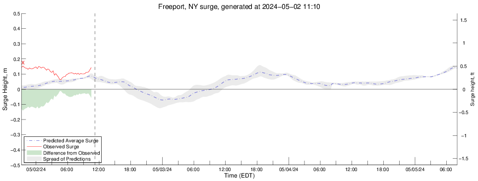
Sea Conditions at
FREEPORT
Long Island, New York USA
Latitude 40 degrees 37.7 minutes North
Longitude 73 degrees 34.3 minutes West
Page last updated 03/27/2025 22:55 EDT
Station status: Station operating normally.
Phase of the Moon
Sunrise: 06:41 AM EDT
Sunset: 07:13 PM EDT
NOTES:
- The Storm Surge model is under development and predictions for sea level height are for research purposes only. They should never be used for navigational purposes or emergency planning under any circumstances.
- Tide instrument 01310521 operated by and data courtesy of the New York Water Resources Division of the United States Geological Survey.
- Real-time data are unchecked and preliminary. Please read this disclaimer.
Current Radar over Long Island
Click on image to enlarge.

About LIShore |
Data Access |
LIShore Home |
Photographs and maps |
Help LIShore grow |
Disclaimer
 LIShore is a project of the School of Marine and Atmospheric Sciences at Stony Brook University in collaboration with the LIShore partners.